Below is Boulder County’s post meeting response to several questions that could not be answered during the limited time of the recent CO119 online public meeting.
C4C continues to support this project. The County’s position in general and below responses are both good in the opinion of C4C.
C4C’s focus on this project is construction funding to complete the project in order to continue to make Boulder County a great place to live.
| CO 119 BIKEWAY PUBLIC MEETING | Monday, August 30th, 2021 |
| Question | Response |
| Safety | |
| Have you considered how to make access to/from the bikeway safer at the unsignalized crossings on CO 119 including 55th St., Monarch Rd., Oxford Rd., N. 83rd St.? Will rapid-flashing beacons or flashing lights be added for safety? | Multiple crossing treatments will be evaluated for each at-grade crossing location. The evaluation will consider traffic volumes, traffic speeds, sight distance, length and type of crossing and available right-of-way. |
| What is the rationale and effectiveness of Vision Zero? | The County adopted a vision zero goal because any traffic deaths are too many. Progress happens slowly but Europe is showing it is possible with sustained effort. The county is focused on variety of countermeasures, such as permitted left turns, putting reflective backplanes on signals and additional signage tailored to the specific crash trends and patterns that are shown in the Crash data analysis. |
| Will CDOT consider returning the speed limit to 55 mph? | There are no plans to change the speed limit at this time. When CO 119 was initially designed a detailed design and analysis was performed to determine the safe speed based on the terrain, proposed geometry, drainage and many other factors. The posted speed is always 5 mph less than the design speed. To change the posted speed limit now, CDOT would have to do the speed study. Oftentimes a speed study recommends speed limits higher than those that are already posted. |
| Maintenance | |
| Will underpasses be treated for ice? What will winter maintenance consist of? | The design team is evaluating multiple approaches to keeping the bikeway ice free. One important component of designing the bikeway is to have a crown or slope and curb and gutter similar to the way roads are constructed so snowmelt and rain can drain quickly. We are also considering specific treatments where ice can be expected, such as the north facing side of an underpass. Plowing and spot treatment of de-icer is planned. |
| How will CDOT prioritize maintenance (i.e. snow removal) of the trail vs. vehicle travel lanes? | Snow removal on the bikeway will likely follow similar protocols as the US 36 Bikeway, which is plowed after 1 inch of snow and before 7:00am. The bikeway will be plowed using a smaller plow than the road, and the maintenance of one will not be prioritized over the other. |
| With all of these underpasses, how are you going to prevent flooding on poor weather days? | The Bikeway design team knows that drainage in and near the underpasses is an important engineering component of a successful bikeway. Drainage at each proposed underpass will be evaluated so that each underpass will be able to drain small storm events. |
| Mobility & Connections | |
| Are you working with RTD to ensure no conflicts between this bikeway project and a future Northwest Commuter rail? | Yes. We are working closely with RTD and CDOT to ensure the bikeway connects seamlessly to existing and future transit opportunities, including SH119 Bus Rapid Transit and RTD’s Northwest passenger rail service. |
| Will improvements to the LoBo trail be deemphasized because of the 119 Bikeway? Will the LoBo trail be paved? | The vision for the bikeway is to provide a direct, paved facility that is plowed during the winter. The LoBo trail is a Parks and Open Space trail. The design standard for Parks and Open Space trails is soft surface. Paving the LoBo trail would require an exemption from this standard and would need to be approved by the Board of County Commissioners. the LoBo trail maintenance and projects to address gaps are not going to be deemphasized because of the 119 Bikeway. |
| Is there an interconnection from this path to the US 36 southbound bike trail to Denver? | the bikeway will connect into 47th street in Boulder which connects to the Foothills Parkway bikeway which can used to access the US 36 Bikeway. |
| How will people connect from Jay Rd. (both west and south) safely to the path? | the design plan calls for an underpass at Jay road with connections to and from the underpass on both sides of the road. |
| Could the last mile consideration be expanded at Airport Rd.? | The First and Final Mile study did not look specifically at Airport Road but many of the same principles discussed in that study can be applied to Airport Road. |
| Does Longmont have plans for a north-south corridor on the western edge of town? Northbound cyclists arriving in Longmont via the blue or red alignments will be funneled onto a sidewalk on the west side of Hover St. This area does not have bicycle infrastructure. Riders wishing to continue northbound must either head west to Airport Rd. or east to Sunset Ave. What plans, if any, does the city of Longmont have to improve bicycle travel along the Hover corridor? | Upcoming developments on the west side of Hover, north of Nelson, will help people connect north in the near term. Additionally, a signal will be added between Nelson Rd and Boston Ave/Rogers Rd to help people on bicycles or walking better access the to-be expanded sidepath system along Hover. |
| Will the 61st Street bike path connection to the Boulder trail system be completed first? | The 61st project is a City of Boulder project. The timelines vary for the Confluence Area Multi-Use Paths projects led by the City of Boulder. More information can be found here: https://bouldercolorado.gov/projects/confluence-area-multi-use-path-projects |
| Can you work with BNSF (Railroad) connect the railroad crossing to Cottonwood trail? | We are currently working with BNSF Railroad on an underpass that will connect Cottonwood Trail to the 119 Bikeway. We do not have a timeline for construction at this time. |
| Cost & Funding | |
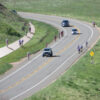
| Do you have a cost/benefit analysis that demonstrates the need for this project? | Typically, transportation decisions are made through studies and public input. The decision for the bikeway was made through the Northwest Area Mobility Study in 2014 and then the Planning and Environmental Linkages study in 2018. Both studies had a public input component. The county also sets transportation goals and vision through the Transportation Master Plan. Separated bicycle facilities has consistently been something the public has requested during the 2019 Transportation Master Plan revision process and other public input. The county also relies on crash data analysis to set priorities for improvement. the data shows the 119 corridor has the highest severe and fatal crash numbers in the county. |
| What is the current expected cost of the project? Is it possible to use funds that are available from the Colorado Lottery for parks and recreation? Since there is no funding allocated at this time, why does a presumed budget constraint the design, instead of the design determining the budget? |
The project funding is broken up into two parts: Planning and then Construction. The Conceptual plan was funded by CDOT. The preliminary and final design is fully funded through a DRCOG grant of $1.3 million plus approximately $1.34 million from the County regional trails program which is funded through sales tax. We need to work within the grant funds that are already awarded to the county to complete the design and design a bikeway that meet the needs of community while being fiscally responsible by designing a bikeway that can be funded and completed. Construction for the project is not yet funded and is estimated to cost $30- 35 million. The county is looking at every possible funding source for the construction funds. At this time the project may not be a good fit for the Colorado Lottery funds, but we are in touch with their staff and are ready to act if it is a good fit. |
| Noise, Lighting & Environment | |
| Will there be a green buffer to create shade, and block noise & exhaust from the roadway? | There are no plans for noise mitigation for bikeway users at this time. There are no plans to irrigate the median to provide the necessary water for additional plant life but the median does have trees that depending on the final design of the bikeway will be accessible from the bikeway. |
| Concern about noise and fumes from the cars. Biking the US 36 bike path is not pleasant because of the fumes. What is the possibility of putting more of the bikeway outside the median — perhaps acquiring right-of-way? | The vision for the corridor is to provide a direct commuter path and to remain within CDOT right-of-way, thought there may be small sections that will require buying additional right-of way. Any right-of- way outside of the median will be costly and time consuming. If the bikeway were to be built outside of the CDOT right-of-way in the median the project could take decades and cost millions more than projected. |
| Is there a plan for lighting along the bikeway, other than in underpasses? The existing underpass paralleling southbound CI 119 at Airport Rd. is poorly lit and not safe for nighttime riding, and this mistake should not be repeated. | the plans currently call for lighting at underpasses, lighting will be included along the corridor at bridge locations, trail connections, and BRT station access at 63rd St. and Niwot Road. |
| Design Elements & Specific Locations | |
| Is this expected to be a 15-foot wide bikeway? | The bikeway width will vary along the corridor with a typical width of 12′ and wider widths in high activity areas. |
| What will the surface material be? | The surface will be concrete. |
| Will the intersections (when bikes must cross traffic) be protected and/or calmed? Protected meaning a bridge or underpass. Calmed meaning raised intersection to slow traffic to watch for bikes. | Underpasses have been identified at the following intersections: Jay Road, 63rd Street, SH 52, and Niwot Road and possibly Airport Road. Multiple crossing treatment options are being evaluated for each at-grade crossing. The evaluation will consider traffic volumes, traffic speeds, sight distance, length and type of crossing and available right-of-way. |
| Will the current intersections for vehicles be improved for efficiency, meaning roundabouts or more predicted model of traffic light signal rotation? | CDOT is not planning to have any roundabouts in this corridor. However, we do have an Adaptive Signals project ongoing and it should be implemented as early as spring next year. |
| Will adjacent crusher fines paths for walkers and runners be provided? | Due to funding and width of the right-of- way an adjacent path is not being considered. |
| The proposed design has multiple underpasses (tunnels) going deep under county roads. How much distance is needed to ramp down and return to grade after in order to maintain the commuter speed? | The maximum grade on the trail will be limited to 5%. A typical underpass is approximately 15 feet below the normal grade of the trail. At 5%, this means we need a distance of 300 feet to transition into and out of underpasses. |
| Have you considered making use of the LoBo trail from N. 83rd St. northbound? It would be a nice benefit if it were possible to add an underpass for CO 119 southbound at that point (going to Airport Rd.) and pave the LoBo trail from N. 83rd St. to where it is concrete at 95th St./Hover St. | Improvements to the LoBo trail are outside the scope of this project. |
| Have you considered “trailhead” parking facilities for users of this corridor, at Boulder and Longmont? | There will be transit station parking at Niwot, Highway 52 and 63rd that will be able to be used as trail access parking. |
| Is there a plan to signalize the northeast bound CO 119 at Airport Rd. to make it easier for cars trying to get on or across CO 119 from southbound Airport Rd.? | CDOT is planning to address signals at the Airport Road as well as to add the signal in the CO 119 northeast direction. The goal is to accommodate all means of transportation and to ensure safety and improve mobility to all people in the corridor. . |
| How many more tens of feet would a concrete bikeway entail that has some gentle curvatures and softness of design, as opposed to one that is straight and only strives to get commuter bicyclists from Point A to Point B as fast as possible? | The overall length of the path would not increase much by the introduction of gentle curvature. However, the goal of providing a direct path will need to be balanced with aesthetic desires and avoidance of impacts to existing trees and wetlands |
| The current at grade crossing at Airport Rd. is awful. The light doesn’t always work, and it takes forever to change at certain times of day. Will the intersection signaling be completely upgraded to work for bicycles and pedestrians? | CDOT is planning to address signals at the Airport Road as well as to add the signal in the CO 119 northeast direction. The goal is to accommodate all transportation modes and to ensure safety and improve mobility to all people in the corridor. |
| With 12’+ paved bikeway, how about consideration for a 2′ crushed granite shoulder on each side for changing flats/mechanical issues and for riding with tots? | The typical section for the trail, including a paved casual or pedestrian zone, is still being evaluated. Input for this public meeting will help inform the final design. Most sections of the bikeway will have an unpaved shoulder to help with drainage. Constrained sections of the bikeway, such as near underpasses will likely have a curb and gutter to accommodate rain and snow melt. |
| What is the size of the underpass culverts? 8’ x 10’? | Underpass size will vary between 16′ wide x 10 feet tall and 16 feet wide by 8 feet tall depending on project constraints. |
| Would an underpass west of Airport Rd. be difficult? It seems that this would be easier than an underpass at the intersection with CO 119. | The design team is looking at all options for the Airport Road section of the bikeway. Topography, constrained right-of-way, and floodplain location make an underpass at Airport Road challenging. West of the intersection is not within CDOT right-of way and would be costly to acquire and may not be available to purchase but we are investigating all the possibilities to design a safe crossing. |
| Operations | |
| How will the speed differential between e-bikes and conventional bikes be managed? Will there be a speed limit, and how would that be enforced? How will the state law banning Class 3 (28mph) e-bikes from bikeways be enforced? | The design team is very aware that there will be a variety of bikeway users with large speed differences. The design team is planning for a 12- foot bikeway in the sections of the bikeway that are not near transit centers. The higher activity areas and the north and south terminus are expected to have a higher activity level. The design team is considering different types of separation using painted markings and making the path a few feet wider in these higher activity areas. |
| Will dogs be allowed? | The design and management team has not yet addressed this question. |
| Will other PEVs, like electric skateboards and electric scooters, be allowed? | The design and management team has not yet addressed this question. |
| Could the extra lane be a dedicated bus lane, no other traffic. Almost like a train? | Currently CDOT is in the process of evaluating several alternatives. One of those alternatives is a bus queue jump lane. If this alternative is selected, these lanes would be added at intersections only and would allow the buses to move up to the front of the line at intersections. BRT prioritization is a consideration for the other alternatives as well. |
| Will bikes be able to use a wide shoulder on the roadway as we do today? | At this point in the planning process, CDOT anticipates that the shoulders will remain open for cyclists who choose this option. |
| Has there been any thought to having the bike path covered to promote commuting in inclement weather, and perhaps use solar panels as shelter, to light the path, and generate energy? | Covering the bikeway would likely be cost prohibitive and may cause ice buildup in the winter by blocking the sun. The design team will evaluate the use of solar when we begin to work on the details of the lighting plan. |
| Are you expecting slower bikes, pedestrians, etc? | Yes, the bikeway is expected to serve all user types, including bike commuters, slower cyclists and pedestrians. |
| Amenities | |
| Will there be rest shelters, water, restrooms or food trucks along the bikeway? | We understand that amenities such as rest shelters, water, and restrooms are important to bikeway users. Considerations for these types of improvements will happen later in project development. We are not planning on food trucks along the bikeway because that would require trucks to drive on the bikeway. Food trucks would be a better fit in towns along the bikeway. |
| Construction & Implementation | |
| What is the timing of the various components of the construction? Will all the roadway changes happen before the bikeway gets built? | Construction will be dependent on funding. The project may be built in phases. Boulder County is working closely with CDOT and RTD on the “touch once” approach so that one area of the road and bikeway is under construction only once. |
| Underpasses are expensive and will take time to fund. Are temporary at grade crossings being considered to speed up a Phase 1 of this project? | We are considering building the bikeway in phases and complete each phase fully to have a one touch construction approach and to construct the safest crossings possible. |