Progress on The South Saint Vrain/CO7 Project
CDOT and Kiewat Corporation’s May 26th, 2022 on-site presentation and tour of the construction on CO7/South Saint Vrain communicated to the public the progress the two organizations are making on the project.
Both CDOT and Kiewat are rightfully proud of the impressive work they’re performing in a complex construction zone. They thanked area residents and expressed their gratitude to be working on the final 2013 flood repair project. There was special excitement around the care the project demonstrates towards the adjacent river.
What remained understated in the presentation was the altered scope of the project. The change represents a small shift away from a congestion based “roadway” mentality and towards an accountable network capacity approach. Building bigger roads has produced decades of negative returns to society. Alternatively, accounting for the sum of the costs of roadways and adapting accordingly is the challenge in setting policy and engineering standards.
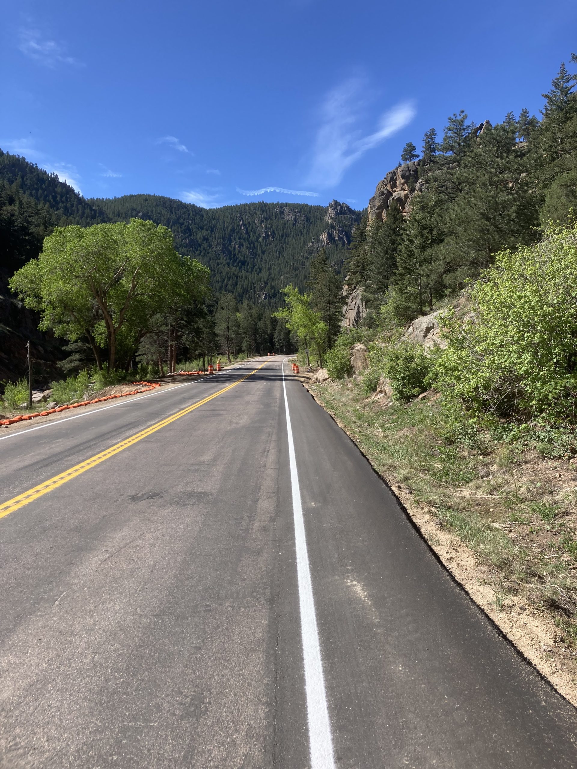
The repaired road’s margins were decided by river health on one side and the escarpment on the other side, not by flawed demand metrics commonly employed to justify construction of a bigger roadway. There is no significant widening and the project involved no blasting. The material fill from the project was all kept within the site’s boundaries which simplifies the outcome versus reverting to practices that make everything bigger and costlier. For a similar comparison, reference the recent CDOT decision not to widen I-25 in Denver.
Overall, this is good for cycling but it involves trade-offs. Cyclists will have an improved 4’ bike-able shoulder on the uphill, climbing lane. The uphill shoulder will narrow to 3’ in a few places where the right-of-way is constricted by the river and the escarpment.
“Paint is not protection” and a white line between cyclists and auto volumes and speeds in the canyon will not prevent collisions resulting in serious injuries and fatalities. Alternatively, the prescribed engineering intervention in such an auto speed-volume environment is a separated bike path. A separated path would have been virtually impossible or prohibitively expensive in the canyon’s topography.
Descending cyclists will often have to “take the lane” due to the roughly 2’ eastbound shoulder. The thinking is that cyclists going downhill will travel near the posted speed limit and flow with traffic. In practice, any cyclist will confirm, it’s not that simple.
On each of these topics, C4C has engaged CDOT in discussions about signage, the posted speed limit, and other variables that affect safety. These are not simple discussions and both sides have reasonable arguments.
C4C has a good relationship with the Boulder County Sheriff’s Office. There’s an ongoing discussion about enforcement and its role in Boulder County’s Vision Zero policy as well.
Thanks to C4C’s supporters, $27,000 was donated to Bicycle Colorado’s SHIFT Driving program that’s currently in development. The program will consist of high quality digitized content regarding the laws for sharing the roads in Colorado. When the program becomes available, C4C intends to help spread its use in an effort to educate drivers and cyclists about sharing the roads in order to prevent crashes before they happen.
Society cannot afford unlimited engineering costs. Individuals cannot afford serious injuries and fatalities. Promoting education along with enforcing civil regard for life and property is a middle way that C4C supports.
Now the question is, can CDOT and Boulder County partner on scaling site specific and evidence based metrics on all their projects in Boulder County? Can this be done in compliance with the Sustainability in Transportation Law and the Boulder County Transportation Master Plan?
Specifically, can CDOT and Boulder County innovate two new metrics in order to guide and monitor progress?
- A Network Capacity Metric. This would measure compliance with the sustainability in transportation law and the Boulder County TMP. It would account for transportation’s role in land-use, liveability (human flourishing), and emissions for climate and health.
- A Liveability Metric. Safety is a lagging or reactive metric. Adding a leading or proactive metric ties projects to a standard of excellence. This metric could measure proximity of population to a recreational facility along with the quantity and quality of that facility. I.e., how close people are to a safe, connected, and good place to ride or access activity in nature
Government is slow but if the incremental conceptual improvements on the CO7/S. St. Vrain project can be spread to projects across Boulder County, then small successes can be scaled to protecting and improving shared and great ways of life in Boulder County.
*Remember, the cycling closure on CO7/S. St. Vrain remains in place until November, 2022.

The South Saint Vrain, pictured above in interim construction state, is one of Boulder County’s great road riding routes.