Community Cycles And Cyclists 4 Community 2018 Boulder County Transportation Master Plan Recommendations
Compiled by Alexey Davies, Community Cycles and Matt Muir, Cyclists 4 Community with a contribution from The Boulder Mountain Bike Alliance
October, 2018
- Adoption of comprehensive Vision Zero Strategies And Action And Safe Systems supported by objective evidence based best practices such as leading NACTO standards applied to County roadways with the goal of zero deaths by 2033
- Prioritization of capital improvement plans and projects according to decisions based on safety data
- Long-term, important projects
- E.g., A separated multi-modal corridor from Boulder to Lyons based on high incident, injury, and death rates on that corridor
- E.g., Structural implementation of low-stress multi-modal networks to encourage more and safer cycling in the County in conjunction with municipal partners and, if possible, neighboring counties
- Long-term, important projects
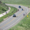
- Ability to act on urgent projects like the rapid adaptation on Jay Road.
- E.g., Community feedback and data showed the need to adapt outside long term planning criteria and to adapt quickly. Jay Road is a working model for interim re-engineering of corridors in order to rapidly mitigate hazards until comprehensive improvements can be done
- Prioritization of capital improvement plans and projects according to decisions based on safety data
- Inclusion of community driven projects
- Community Cycle’s desire for regional connectivity particularly with respect to E-bike commuting
- C4C’s support for,
- Separated multi modal corridor Boulder to Longmont/119/Diagonal Highway as part of the larger corridor project
- Lee Hill uphill shoulder improvement both directions
- Sunshine Canyon uphill to end of pavement, shoulder improvement
- 75th St. north of CO 66 to County Line, 6’ shoulders
- Isabelle Road from 95th to one half mile east of 287, 6’ shoulders
- Arapahoe from 75th to 287, 6’ shoulders
- The Boulder Mountain Bike Alliance’s support for
- On-trail connectivity from the City’s multi-modal paths to the islands of recreation which Mountain Bikers utilize such as the Eldorado Canyon to Walker Ranch connection
- The expansion of trails in Hall and Heil Ranch which are currently planned (Hall 2 and the Schoolhouse Loop)
- References
- Community Cycle’s and C4C’s shared County TMP Input map that shows desired improvements in the City and County at https://www.google.com/maps/d/u/1/viewer?ll=40.01951378720447%2C-105.25033509033204&z=12&mid=1Tq7Zyygsn6QoMnu7Tlc0XOWnqV0BeIYh
- https://visionzeronetwork.org/
- http://www.towardszerofoundation.org/thesafesystem/
Please note, these may be revised
Comments may be sent to info@c4community.org
Thank you for supporting Cyclists 4 Community